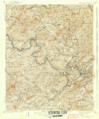
1938 Map of Fowler Bend
USGS Topo · Published 1938About this map
Murphy Indian Res Henson Donation occupies the eastern portion of this 1930s landscape, where the Hiwassee River and Nottely River converge near the town of Murphy. This era of the Tennessee Valley's history is captured shortly after the construction of Nottely Dam, showing the early hydrological management of these mountain waterways. The rugged topography of the Unicoi Mountains and Nantahala National Forest is dotted with rural landmarks of the period, such as Dockery Store and Radford Mill. Genealogists will find a detailed network of family-centered infrastructure, including Old Friendship Cem and numerous country schools like Grape Creek Sch and Ebenezer Sch. The industrial presence of the region is noted by the L & N RR corridor and a Talc Mine, illustrating the intersection of natural resources and railroad transport in western North Carolina.
Find a feature on this map
132 named features on this map. Tap any name to fly to it.
Don’t see what you’re looking for? This feature index may not catch every label — zoom into the map to look around manually.
Map Details
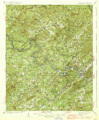
Editions of this 1938 Fowler Bend Map
2 editions found
Other maps of this area

1886 · Dahlonega
USGS Topo · 1:125,000

1888 · Ellijay
USGS Topo · 1:125,000

1892 · Dahlonega
USGS Topo · 1:125,000

1892 · Ellijay
USGS Topo · 1:125,000

1893 · Murphy
USGS Topo · 1:125,000

1896 · Dahlonega
USGS Topo · 1:125,000

1898 · Ellijay
USGS Topo · 1:125,000

1903 · Dahlonega
USGS Topo · 1:125,000

1911 · Ellijay
USGS Topo · 1:125,000

1914 · Murphy
USGS Topo · 1:125,000