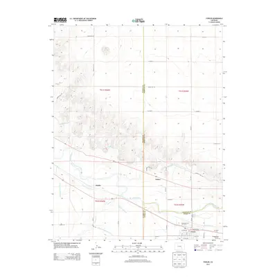
2013 Map of Fowler
USGS Topo · Published 2013About this map
The Arkansas River forms the central artery of this 2013 survey, where the town of Fowler serves as a hub of activity at the convergence of three counties. This landscape is defined by its complex irrigation network, critical for agriculture in this arid region, including the Colorado Canal, Oxford Farmers Ditch, and Rocky Ford Highline Canal. These water features follow the contours of the valley, supporting settlements like Hamlet and Pultney. Near the town center, the Fowler Cem and Cottonwood Links Golf Course mark the local geography, while the terrain transitions into the draws of Hungerford Hollow. The map also documents a dense grid of rural roads such as Hagelstein Rd and Nepesta Hill Rd, providing clear insight into the land divisions and transport patterns that have shaped Otero, Crowley, and Pueblo counties.
Find a feature on this map
42 named features on this map. Tap any name to fly to it.
Don’t see what you’re looking for? This feature index may not catch every label — zoom into the map to look around manually.
Map Details
Editions of this 2013 Fowler Map
This is the sole edition of this map. No revisions or reprints were ever made.
Other maps of this area

1891 · Catlin
USGS Topo · 1:125,000

1891 · Nepesta
USGS Topo · 1:125,000

1893 · Nepesta
USGS Topo · 1:125,000

1893 · Catlin
USGS Topo · 1:125,000

1904 · Nepesta
USGS Topo · 1:125,000

1954 · Olney Springs
USGS Topo · 1:24,000

1954 · Elder
USGS Topo · 1:24,000

1954 · Lamar
USGS Topo · 1:250,000

1954 · Pueblo
USGS Topo · 1:250,000

1957 · Pueblo
USGS Topo · 1:250,000