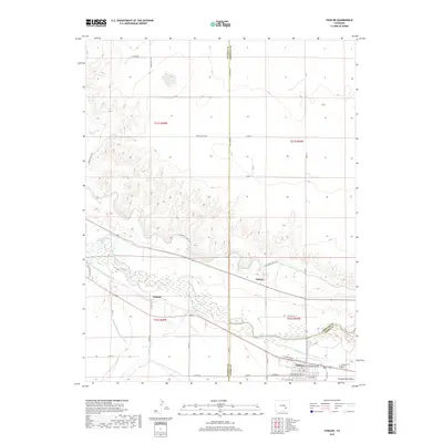
2019 Map of Fowler
USGS Topo · Published 2019About this map
The Arkansas River corridor serves as the central artery for this 2019 survey of the High Plains, where complex water management systems define the landscape. Multiple irrigation routes, including the Colorado Canal, Otero Canal, and the Rocky Ford Highline Canal, parallel the river's course to support the region's agricultural vitality. The town of Fowler anchors the southern portion of the map, organized around a traditional grid of streets such as W Santa Fe Ave and W Grant Ave. North of the river, the terrain shifts into the broken geography of the Nepesta Hills, where the settlement of Pultney sits at the junction of Co LN 2 and the canal line.
Find a feature on this map
43 named features on this map. Tap any name to fly to it.
Don’t see what you’re looking for? This feature index may not catch every label — zoom into the map to look around manually.
Map Details
Editions of this 2019 Fowler Map
This is the sole edition of this map. No revisions or reprints were ever made.
Other maps of this area

1891 · Catlin
USGS Topo · 1:125,000

1891 · Nepesta
USGS Topo · 1:125,000

1893 · Nepesta
USGS Topo · 1:125,000

1893 · Catlin
USGS Topo · 1:125,000

1904 · Nepesta
USGS Topo · 1:125,000

1954 · Olney Springs
USGS Topo · 1:24,000

1954 · Elder
USGS Topo · 1:24,000

1954 · Lamar
USGS Topo · 1:250,000

1954 · Pueblo
USGS Topo · 1:250,000

1957 · Pueblo
USGS Topo · 1:250,000