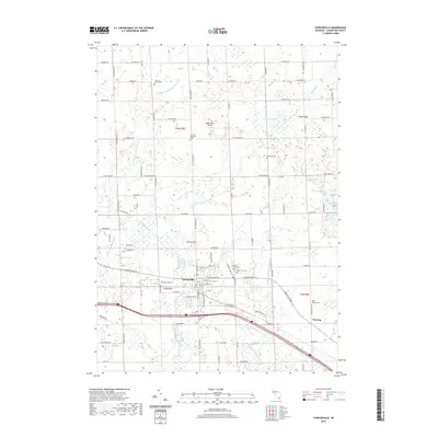
2019 Map of Fowlerville
USGS Topo · Published 2019About this map
Fowlerville serves as the central hub of this Livingston County landscape, situated where the Red Cedar River and its various tributaries, such as the Middle Br Red Cedar River, carve through the glacial terrain. The map documents a sophisticated drainage network essential to the region's agricultural productivity, including the Conway-Cohoctah Union Drain and Handy Howell Drain Number 1. For those tracing local heritage, the sheet is densely populated with historical burial grounds like Conway-Klein Cem, Greenwood Cem, and West Howell Cem, providing clear spatial context for family researchers. North of the village, the small Maple Grove Airport and the waters of Lake Cohoctah and Sabine Lake punctuate a landscape of section lines and country roads that have defined this part of Michigan for generations.
Find a feature on this map
95 named features on this map. Tap any name to fly to it.
Don’t see what you’re looking for? This feature index may not catch every label — zoom into the map to look around manually.
Map Details
Editions of this 2019 Fowlerville Map
This is the sole edition of this map. No revisions or reprints were ever made.
Other maps of this area

1907 · Howell
USGS Topo · 1:62,500

1908 · Fowlerville
USGS Topo · 1:62,500

1909 · Howell
USGS Topo · 1:62,500

1910 · Fowlerville
USGS Topo · 1:62,500

1922 · Durand
USGS Topo · 1:62,500

1926 · Corunna
USGS Topo · 1:62,500

1929 · Corunna
USGS Topo · 1:62,500

1943 · Durand
USGS Topo · 1:62,500

1944 · Corunna
USGS Topo · 1:62,500

1954 · Detroit
USGS Topo · 1:250,000
Featured Places
- Handy Township, MI
- Howell Township, MI
- Conway Township, MI
- Cohoctah Township, MI
- Fowlerville, Handy Township