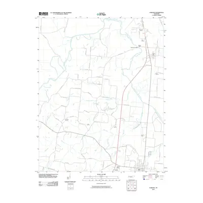
2010 Map of Fowlkes
USGS Topo · Published 2010About this map
Halls anchors the southern portion of this West Tennessee landscape, where the flat agricultural terrain is defined by the winding course of the South Fork Forked Deer River. The map reveals a high density of small family and community burial grounds, such as King Cemetery, Butterworth Cemetery, and the Elon Cemetery, which are often located near long-established rural routes like Key Corner Rd and Chambers Creek Rd. These scattered cemeteries and named landmarks like Yellow Bluff suggest a deeply rooted rural community structure that persists alongside modern developments like Arnold Field. To the north, the Fowlkes Post Office serves as a focal point for the surrounding farms. The drainage patterns of Mill Creek and Chambers Branch illustrate the hydrological importance of the river basin, providing a detailed look at the local topography before the intersection of several local thoroughfares.
Find a feature on this map
70 named features on this map. Tap any name to fly to it.
Don’t see what you’re looking for? This feature index may not catch every label — zoom into the map to look around manually.
Map Details
Editions of this 2010 Fowlkes Map
This is the sole edition of this map. No revisions or reprints were ever made.
Other maps of this area

1939 · Dyersburg
USGS Topo · 1:62,500

1939 · Hales Point
USGS Topo · 1:62,500

1939 · Caruthersville
USGS Topo · 1:62,500

1939 · Halls
USGS Topo · 1:62,500

1951 · Caruthersville
USGS Topo · 1:62,500

1952 · Hales Point
USGS Topo · 1:62,500

1952 · Gates
USGS Topo · 1:24,000

1952 · Bonicord
USGS Topo · 1:24,000

1952 · Newbern
USGS Topo · 1:24,000

1952 · Dyersburg
USGS Topo · 1:24,000