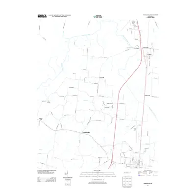
2013 Map of Fowlkes
USGS Topo · Published 2013About this map
The Forked Deer River and its south fork wind through this West Tennessee landscape, defining the rural character of Dyer County in the early 21st century. Small agrarian settlements like Unionville, Poplar Grove, and Four Points are linked by a network of local roads such as Moore School House Rd and Double Bridges Unionville Rd. Notable landmarks for local history include Parr Cemetery and the Poplar Grove Church, which serve as anchors for the surrounding farming community. To the south, the town of Halls shows more concentrated development near Halls Elementary School. The area's connection to regional transportation is highlighted by the presence of Dyersburg Regional Airport in the north and Arnold Field Airport further south, illustrating the modern aviation infrastructure overlying this traditional river-and-rail corridor. The elevation shift at Yellow Bluff and the crossing at Yellow Bluff Bridge provide distinct topographical markers along the river's path.
Find a feature on this map
110 named features on this map. Tap any name to fly to it.
Don’t see what you’re looking for? This feature index may not catch every label — zoom into the map to look around manually.
Map Details
Editions of this 2013 Fowlkes Map
This is the sole edition of this map. No revisions or reprints were ever made.
Other maps of this area

1939 · Dyersburg
USGS Topo · 1:62,500

1939 · Hales Point
USGS Topo · 1:62,500

1939 · Caruthersville
USGS Topo · 1:62,500

1939 · Halls
USGS Topo · 1:62,500

1951 · Caruthersville
USGS Topo · 1:62,500

1952 · Hales Point
USGS Topo · 1:62,500

1952 · Gates
USGS Topo · 1:24,000

1952 · Bonicord
USGS Topo · 1:24,000

1952 · Newbern
USGS Topo · 1:24,000

1952 · Dyersburg
USGS Topo · 1:24,000