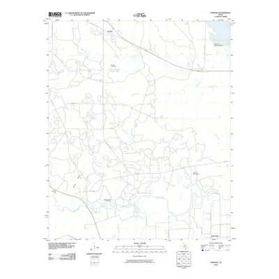
2010 Map of Fowlkes
USGS Topo · Published 2010About this map
The Wichita River and Beaver Creek wind through this North Texas landscape, defining a region characterized by ranching roads and water management at the start of the 21st century. The settlement of Fowlkes sits in the northern reaches along Us HWY 287 Bus, while Valley View anchors the southeastern corner. Water control is a central theme of the geography, evidenced by substantial infrastructure such as the Beaver Creek Lake Dam, Burnett Lake Dam, and the North Fork Buffalo Creek Dam. Local landmarks like Twin Mountain and Turkey Hill provide topographic variety against a network of rural routes including Fowlkes Station Rd and Bradley Ranch Rd. The map captures a transition point where the prairie meets the engineered waterways of the North Fork Buffalo Creek Reservoir, reflecting the modern agricultural and hydrological layout of Wichita County.
Find a feature on this map
36 named features on this map. Tap any name to fly to it.
Don’t see what you’re looking for? This feature index may not catch every label — zoom into the map to look around manually.
Map Details
Editions of this 2010 Fowlkes Map
This is the sole edition of this map. No revisions or reprints were ever made.
Other maps of this area

1915 · Clara
USGS Topo · 1:24,000

1915 · Barwise School
USGS Topo · 1:24,000

1916 · Electra
USGS Topo · 1:24,000

1916 · Iowa Park
USGS Topo · 1:24,000

1916 · Fowlkes
USGS Topo · 1:24,000

1917 · Beaver Creek
USGS Topo · 1:24,000

1918 · Electra
USGS Topo · 1:31,680

1918 · Barwise School
USGS Topo · 1:31,680

1918 · Clara
USGS Topo · 1:31,680

1918 · Iowa Park
USGS Topo · 1:31,680