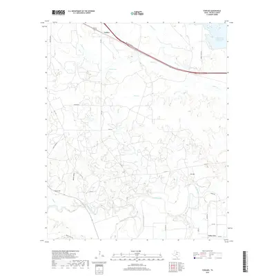
2019 Map of Fowlkes
USGS Topo · Published 2019About this map
The Wichita River winds through the southern landscape of Wichita County, defining a territory characterized by complex drainage systems and ranching infrastructure. Near the northern boundary, the community of Fowlkes sits along the corridor of Bus 287 and the Hwy 287 Access Rd, serving as a focal point for transportation in the area. The hydrography of the region is notably intricate, with numerous tributaries such as Whisky Cr, Wolf Cr, and Horse Cr carving through the terrain toward the river. Distinctive landforms like Turkey Hill and Twin Mtn provide relief against the low-lying basins of Bolivar Hollow. This map also highlights significant water management and private landholdings, including the North Fork Buffalo Creek Reservoir and Burnett Lake, as well as established local routes like Burnett Ranch Rd and Bradley Ranch Rd that connect isolated homesteads and pastures.
Find a feature on this map
37 named features on this map. Tap any name to fly to it.
Don’t see what you’re looking for? This feature index may not catch every label — zoom into the map to look around manually.
Map Details
Editions of this 2019 Fowlkes Map
This is the sole edition of this map. No revisions or reprints were ever made.
Other maps of this area

1915 · Clara
USGS Topo · 1:24,000

1915 · Barwise School
USGS Topo · 1:24,000

1916 · Electra
USGS Topo · 1:24,000

1916 · Iowa Park
USGS Topo · 1:24,000

1916 · Fowlkes
USGS Topo · 1:24,000

1917 · Beaver Creek
USGS Topo · 1:24,000

1918 · Electra
USGS Topo · 1:31,680

1918 · Barwise School
USGS Topo · 1:31,680

1918 · Clara
USGS Topo · 1:31,680

1918 · Iowa Park
USGS Topo · 1:31,680