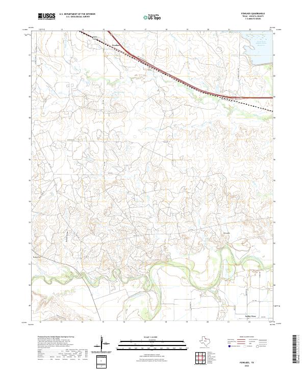
2022 Map of Fowlkes
USGS Topo · Published 2022About this map
The Wichita River carves a winding path across this portion of Wichita County, defining a landscape shaped by both water and ranching. Small settlements like Fowlkes in the north and Valley View in the southeast are connected by a network of rural routes, including FM 2384 and FM 1206. The presence of Refinery Rd near the river suggests the industrial footprints of the local oil economy, while names like Bradley Ranch Rd and Burnett Ranch Rd point to the area's agricultural heritage. Significant water features such as the North Fork Buffalo Creek Reservoir and Burnett Lake anchor the northern landscape. Local landmarks such as Midway Church, Turkey Hill, and Twin Mtn provide distinct navigational points for those tracing local family roots or the history of this Texas ranching corridor.
Find a feature on this map
35 named features on this map. Tap any name to fly to it.
Don’t see what you’re looking for? This feature index may not catch every label — zoom into the map to look around manually.
Map Details
Editions of this 2022 Fowlkes Map
This is the sole edition of this map. No revisions or reprints were ever made.
Other maps of this area

1915 · Clara
USGS Topo · 1:24,000

1915 · Barwise School
USGS Topo · 1:24,000

1916 · Electra
USGS Topo · 1:24,000

1916 · Iowa Park
USGS Topo · 1:24,000

1916 · Fowlkes
USGS Topo · 1:24,000

1917 · Beaver Creek
USGS Topo · 1:24,000

1918 · Electra
USGS Topo · 1:31,680

1918 · Barwise School
USGS Topo · 1:31,680

1918 · Clara
USGS Topo · 1:31,680

1918 · Iowa Park
USGS Topo · 1:31,680