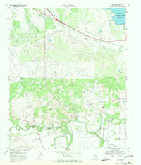
1968 Map of Fowlkes
USGS Topo · Published 1971About this map
The Electra Oil Field and K M A Oil Field dominate this North Texas landscape, where a dense network of oil wells and pipelines reveals the mid-century industrial footprint near the Wichita-Wilbarger county line. The terrain is defined by the winding course of the Wichita River and Beaver Creek, which converge in the southern portion of the quadrangle. High ground is marked by Turkey Hill and Twin Mtn, providing a contrast to the riparian lowlands.
Find a feature on this map
33 named features on this map. Tap any name to fly to it.
Don’t see what you’re looking for? This feature index may not catch every label — zoom into the map to look around manually.
Map Details
Editions of this 1968 Fowlkes Map
This is the sole edition of this map. No revisions or reprints were ever made.
Other maps of this area

1915 · Clara
USGS Topo · 1:24,000

1915 · Barwise School
USGS Topo · 1:24,000

1916 · Electra
USGS Topo · 1:24,000

1916 · Iowa Park
USGS Topo · 1:24,000

1916 · Fowlkes
USGS Topo · 1:24,000

1917 · Beaver Creek
USGS Topo · 1:24,000

1918 · Electra
USGS Topo · 1:31,680

1918 · Barwise School
USGS Topo · 1:31,680

1918 · Clara
USGS Topo · 1:31,680

1918 · Iowa Park
USGS Topo · 1:31,680