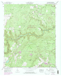
1946 Map of Fox Creek
USGS Topo · Published 1976About this map
Catoosa Wildlife Management Area dominates this section of the Cumberland Plateau, where the Obed River carves through the terrain. The landscape is defined by its numerous family burial grounds and small community focal points, such as Henry Cem, Goss Cem, and Neal Chapel. These markers of early settlement persist even as the region transitioned toward conservation and recreation, evidenced by the later emergence of Fairfield Glade and its golf course in the southern portion.
Find a feature on this map
64 named features on this map. Tap any name to fly to it.
Don’t see what you’re looking for? This feature index may not catch every label — zoom into the map to look around manually.
Map Details
Editions of this 1946 Fox Creek Map
3 editions found
Other maps of this area

1887 · Kingston
USGS Topo · 1:125,000

1891 · Kingston
USGS Topo · 1:125,000

1892 · Pikeville
USGS Topo · 1:125,000

1893 · Kingston
USGS Topo · 1:125,000

1895 · Wartburg
USGS Topo · 1:125,000

1895 · Pikeville
USGS Topo · 1:125,000

1896 · Wartburg
USGS Topo · 1:125,000

1897 · Standingstone
USGS Topo · 1:125,000

1898 · Standingstone
USGS Topo · 1:125,000

1912 · Crossville
USGS Topo · 1:62,500