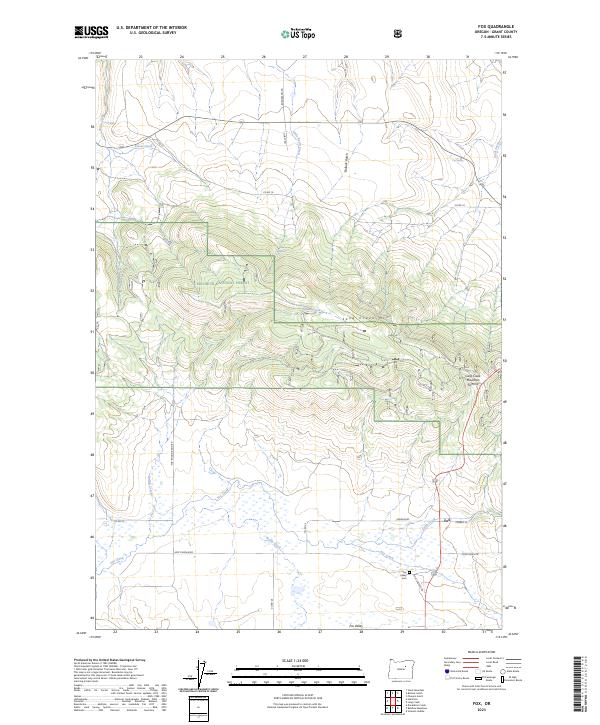
2023 Map of Fox
USGS Topo · Published 2023About this map
Fox Valley and the small settlement of Fox anchor this portion of Grant County, where the high-elevation terrain of Malheur National Forest meets the lower grazing lands of the valley floor. The landscape is defined by the steep slopes of Long Creek Mtn, reaching its peak at Long Creek Mountain Summit. This transition from timbered forest to open basin is traced by a network of drainage systems, including the meandering Fox Creek and its tributaries like Wyllie Creek and Smith Creek. For genealogists and local historians, the Fox Valley Cem is a primary landmark situated near the junction of Fox Cemetery Rd and the highway. The map reflects a rural economy dependent on these water sources and mountain passes, connected by backroads such as Borgerson Rd and Fox-Round Basin Rd that skirt the forest boundaries.
Find a feature on this map
34 named features on this map. Tap any name to fly to it.
Don’t see what you’re looking for? This feature index may not catch every label — zoom into the map to look around manually.
Map Details
Editions of this 2023 Fox Map
This is the sole edition of this map. No revisions or reprints were ever made.
Other maps of this area

1949 · Long Creek
USGS Topo · 1:62,500

1950 · Ritter
USGS Topo · 1:62,500

1951 · Long Creek
USGS Topo · 1:62,500

1951 · Courtrock
USGS Topo · 1:62,500

1951 · Monument
USGS Topo · 1:62,500

1952 · Ritter
USGS Topo · 1:62,500

1955 · Canyon City
USGS Topo · 1:250,000

1959 · Canyon City
USGS Topo · 1:250,000

1980 · Monument
USGS Topo · 1:100,000
1990 · Donaldson Creek
USGS Topo · 1:24,000