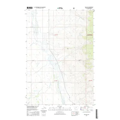
2017 Map of Fox Gulch
USGS Topo · Published 2017About this map
Big Hole River winds through this high-country landscape, where the open basin of the Big Hole Valley meets the rising timberline of the Beaverhead National Forest. This 2017 survey details a network of vital waterways and drainages, including Warm Springs Cr and Cow Cabin Cr, which have long supported the region's ranching heritage. The presence of the Popularis Cem near the southern boundary provides a rare genealogical point of interest in this sparsely populated area.
Find a feature on this map
22 named features on this map. Tap any name to fly to it.
Don’t see what you’re looking for? This feature index may not catch every label — zoom into the map to look around manually.
Map Details
Editions of this 2017 Fox Gulch Map
This is the sole edition of this map. No revisions or reprints were ever made.
Other maps of this area

1955 · Dillon
USGS Topo · 1:250,000

1957 · Dillon
USGS Topo · 1:250,000

1958 · Dillon
USGS Topo · 1:250,000

1962 · Dillon
USGS Topo · 1:250,000

1962 · Wisdom
USGS Topo · 1:24,000

1962 · Stewart Mountain
USGS Topo · 1:24,000

1965 · Dillon
USGS Topo · 1:250,000

1966 · Miner Lake
USGS Topo · 1:24,000
1966 · Ajax Ranch
USGS Topo · 1:24,000
1966 · Highland Ranch
USGS Topo · 1:24,000