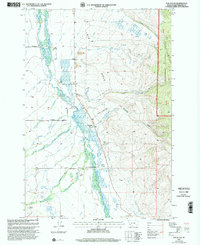
1997 Map of Fox Gulch
USGS Topo · Published 2002About this map
The Big Hole River dominates this Beaverhead County landscape, winding through a complex system of marshes and smaller tributaries like Swamp Creek and Little Lake Creek. This 1997 revision highlights the enduring ranching culture of southwest Montana, documenting family operations such as the Fred Hirschy Ranch, 40 Bar Ranch, and Willow Ranch. These settlements are linked by a network of rural roads including Jorgenson Lane and Peterson Lane, reflecting the remote but organized agricultural infrastructure of the era.
Find a feature on this map
34 named features on this map. Tap any name to fly to it.
Don’t see what you’re looking for? This feature index may not catch every label — zoom into the map to look around manually.
Map Details
Editions of this 1997 Fox Gulch Map
This is the sole edition of this map. No revisions or reprints were ever made.
Other maps of this area

1955 · Dillon
USGS Topo · 1:250,000

1957 · Dillon
USGS Topo · 1:250,000

1958 · Dillon
USGS Topo · 1:250,000

1962 · Dillon
USGS Topo · 1:250,000

1962 · Wisdom
USGS Topo · 1:24,000

1962 · Stewart Mountain
USGS Topo · 1:24,000

1965 · Dillon
USGS Topo · 1:250,000

1966 · Miner Lake
USGS Topo · 1:24,000
1966 · Ajax Ranch
USGS Topo · 1:24,000
1966 · Highland Ranch
USGS Topo · 1:24,000