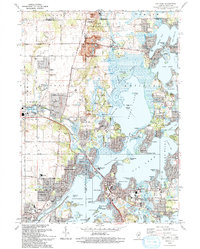
1993 Map of Fox Lake
USGS Topo · Published 1993About this map
The intricate waterways of the Chain O' Lakes dominate this early 1990s landscape, where the Fox River and Nippersink Creek connect a series of glacial basins. The map captures the dense recreational and residential settlement patterns of Fox Lake, Pistakee Highlands, and Ingleside, showing how local life revolves around the water. On Grass Lake, landmarks like Blarney Island and Grass Island stand out alongside the vast Chain O'Lakes State Park. Evidence of the area's older history remains in the Wray-Imeson Cem and Cole Cem, while the Chicago and North Western railroad provides a vital transportation corridor through the southern half of the quadrangle. Northward, Gander Mountain rises above the lowlands, providing a clear topographic contrast to the surrounding marshes and bays.
Find a feature on this map
100 named features on this map. Tap any name to fly to it.
Don’t see what you’re looking for? This feature index may not catch every label — zoom into the map to look around manually.
Map Details
Editions of this 1993 Fox Lake Map
This is the sole edition of this map. No revisions or reprints were ever made.
Other maps of this area

1893 · Silver Lake
USGS Topo · 1:62,500

1893 · Geneva
USGS Topo · 1:62,500

1904 · Lake Geneva
USGS Topo · 1:62,500

1906 · Silver Lake
USGS Topo · 1:62,500

1906 · Lake Geneva
USGS Topo · 1:62,500

1920 · Grays Lake
USGS Topo · 1:62,500

1923 · Grays Lake
USGS Topo · 1:62,500

1926 · Mc Henry
USGS Topo · 1:62,500

1944 · McHenry
USGS Topo · 1:62,500

1954 · Rockford
USGS Topo · 1:250,000