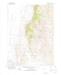
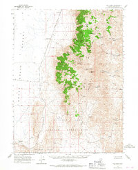
1965 Map of Fox Range
USGS Topo · Published 1978About this map
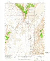
The Smoke Creek Desert dominates the western edge of this landscape, creating a stark contrast to the elevation of the Fox Range. In the mid-1960s, this region of Nevada was defined by a sparse network of small settlements and transportation corridors, with the Western Pacific railroad serving as the primary artery through the desert flats, passing through Reynard and Sano.
Find a feature on this map
45 named features on this map. Tap any name to fly to it.
Don’t see what you’re looking for? This feature index may not catch every label — zoom into the map to look around manually.
Map Details
Editions of this 1965 Fox Range Map
2 editions found
Other maps of this area

1886 · Granite Range
USGS Topo · 1:250,000

1894 · Granite Range
USGS Topo · 1:250,000

1955 · Lovelock
USGS Topo · 1:250,000

1959 · Lovelock
USGS Topo · 1:250,000
1964 · The Needle Rocks
USGS Topo · 1:24,000
1964 · Tohakum Peak NW
USGS Topo · 1:24,000
1964 · Gerlach
USGS Topo · 1:62,500
1964 · Astor Pass
USGS Topo · 1:24,000
1964 · Kumiva Peak
USGS Topo · 1:62,500
1964 · Pyramid NE
USGS Topo · 1:24,000