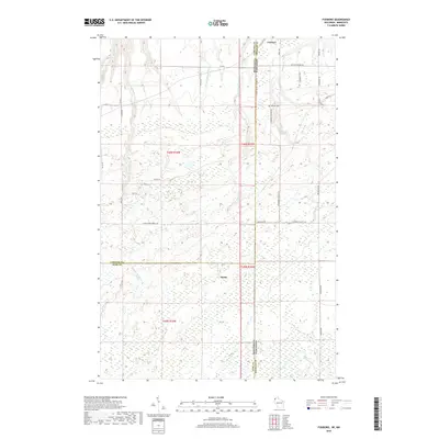
2018 Map of Foxboro
USGS Topo · Published 2018About this map
Foxboro and Harlis anchor this borderland survey where northern Minnesota and Wisconsin converge. The landscape is defined by its complex hydrology, featuring the Net River, Little Net River, and the winding course of State Line Cr. The state boundary is further reinforced by S State Line Rd Co Hwy B, while the presence of Summit Cem offers a focal point for genealogical research in this sparsely settled region.
Find a feature on this map
36 named features on this map. Tap any name to fly to it.
Don’t see what you’re looking for? This feature index may not catch every label — zoom into the map to look around manually.
Map Details
Editions of this 2018 Foxboro Map
This is the sole edition of this map. No revisions or reprints were ever made.
Other maps of this area

1915 · Superior
USGS Topo · 1:48,000

1917 · Superior
USGS Topo · 1:62,500

1949 · Holyoke
USGS Topo · 1:48,000

1949 · Patzau
USGS Topo · 1:48,000

1953 · Duluth
USGS Topo · 1:250,000

1954 · Borea
USGS Topo · 1:24,000

1954 · Foxboro
USGS Topo · 1:24,000

1954 · Wrenshall
USGS Topo · 1:24,000

1954 · Frogner
USGS Topo · 1:24,000
1954 · Patzau
USGS Topo · 1:24,000