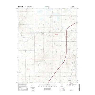
2016 Map of Francisco
USGS Topo · Published 2016About this map
Francisco is the central hub of this agricultural and resource-rich landscape in Gibson County. The town's grid is defined by streets like W Chestnut St and W Main St, situated just west of the winding Keg Creek. South of town, the landscape is marked by the legacy of local industry, specifically noted by the presence of Number Two Coalmine Rd. To the southeast, the settlements of Somerville and Mackey anchor the lower portion of the map near the Bottoms Brothers Airport. The terrain varies from the low-lying wetlands of the Muddy Ditch and Snake Run drainage areas to the prominent rise of Kennedy Hill in the east. Genealogists and local historians can locate the Meade Cem north of the main settlement, providing a specific point of reference for families rooted in this corner of Indiana.
Find a feature on this map
76 named features on this map. Tap any name to fly to it.
Don’t see what you’re looking for? This feature index may not catch every label — zoom into the map to look around manually.
Map Details
Editions of this 2016 Francisco Map
This is the sole edition of this map. No revisions or reprints were ever made.
Other maps of this area

1901 · Princeton
USGS Topo · 1:62,500

1901 · Haubstadt
USGS Topo · 1:62,500

1902 · Ditney
USGS Topo · 1:125,000

1902 · Boonville
USGS Topo · 1:62,500

1903 · Haubstadt
USGS Topo · 1:62,500

1903 · Petersburg
USGS Topo · 1:62,500

1903 · Princeton
USGS Topo · 1:62,500

1903 · Patoka
USGS Topo · 1:125,000

1956 · Vincennes
USGS Topo · 1:250,000

1957 · Vincennes
USGS Topo · 1:250,000