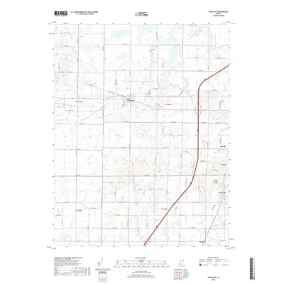
2019 Map of Francisco
USGS Topo · Published 2019About this map
Francisco serves as the central hub of this Indiana landscape, situated where the grid of rural roads meets the local rail corridor. The town's historical foundations are evident in the Ioof Cem and the surrounding farmland, which is intricately partitioned by a network of county roads like Oatsville Rd and Seedtick Rd. The industrial character of the region is quietly noted by Number Two Coalmine Rd, pointing to the area's coal-producing legacy.
Find a feature on this map
49 named features on this map. Tap any name to fly to it.
Don’t see what you’re looking for? This feature index may not catch every label — zoom into the map to look around manually.
Map Details
Editions of this 2019 Francisco Map
This is the sole edition of this map. No revisions or reprints were ever made.
Other maps of this area

1901 · Princeton
USGS Topo · 1:62,500

1901 · Haubstadt
USGS Topo · 1:62,500

1902 · Ditney
USGS Topo · 1:125,000

1902 · Boonville
USGS Topo · 1:62,500

1903 · Haubstadt
USGS Topo · 1:62,500

1903 · Petersburg
USGS Topo · 1:62,500

1903 · Princeton
USGS Topo · 1:62,500

1903 · Patoka
USGS Topo · 1:125,000

1956 · Vincennes
USGS Topo · 1:250,000

1957 · Vincennes
USGS Topo · 1:250,000