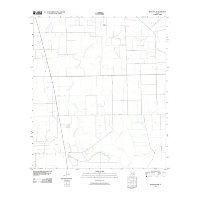
2010 Map of Francitas NW
USGS Topo · Published 2010About this map
The Ganado Oil Field sits at the northern edge of this coastal prairie landscape, highlighting the industrial footprint of petroleum extraction in Jackson County during the early 21st century. The terrain is defined by the winding paths of West Carancahua Creek, Little Carancahua Creek, and Lunis Creek, which drain toward the Gulf. A network of rural roads, many bearing local family names like Kudelka Rd, Roman Vyvial Rd, and Grimes Rd, crisscrosses the quadrangle, reflecting a legacy of generational land ownership and agricultural use. The presence of W Ward Ranch Rd and various private routes like Pvt Rd 2301 underscores the transition between managed ranchland and the structured grid of regional farm-to-market roads like FM 1823.
Find a feature on this map
28 named features on this map. Tap any name to fly to it.
Don’t see what you’re looking for? This feature index may not catch every label — zoom into the map to look around manually.
Map Details
Editions of this 2010 Francitas NW Map
This is the sole edition of this map. No revisions or reprints were ever made.
Other maps of this area

1952 · Francitas NW
USGS Topo · 1:24,000

1952 · Manson
USGS Topo · 1:24,000

1952 · Francitas
USGS Topo · 1:24,000

1952 · Francitas NE
USGS Topo · 1:24,000

1952 · La Ward
USGS Topo · 1:24,000

1952 · Lolita
USGS Topo · 1:24,000

1953 · Beeville
USGS Topo · 1:250,000

1953 · Seguin
USGS Topo · 1:250,000

1956 · Beeville
USGS Topo · 1:250,000

1958 · Seguin
USGS Topo · 1:250,000