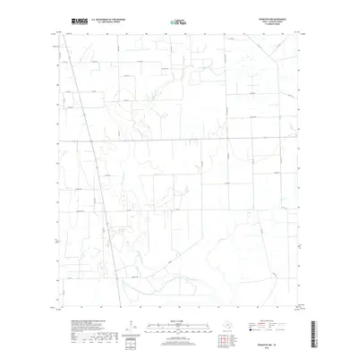
2019 Map of Francitas NW
USGS Topo · Published 2019About this map
The coastal prairie of Jackson County is defined here by the winding course of W Carancahua Cr and its tributaries, Little Carancahua Cr and Lunis Cr. This 2019 survey shows a landscape dominated by agricultural divisions and rural road networks, with long-established family names tied to the local infrastructure. Roads such as Matula Rd, Kudelka Rd, and Jaap Rd suggest a history of multi-generational landholdings in this part of Texas. The presence of Texaco Rd points to the region's intersection with the energy industry, while the concentration of wetlands along the creek basins illustrates the natural drainage patterns that have shaped local ranching and farming since the area was first settled. The network of farm-to-market roads like FM 1823 and FM 1157 provides the primary connectivity across these low-lying plains.
Find a feature on this map
39 named features on this map. Tap any name to fly to it.
Don’t see what you’re looking for? This feature index may not catch every label — zoom into the map to look around manually.
Map Details
Editions of this 2019 Francitas NW Map
This is the sole edition of this map. No revisions or reprints were ever made.
Other maps of this area

1952 · Francitas NW
USGS Topo · 1:24,000

1952 · Manson
USGS Topo · 1:24,000

1952 · Francitas
USGS Topo · 1:24,000

1952 · Francitas NE
USGS Topo · 1:24,000

1952 · La Ward
USGS Topo · 1:24,000

1952 · Lolita
USGS Topo · 1:24,000

1953 · Beeville
USGS Topo · 1:250,000

1953 · Seguin
USGS Topo · 1:250,000

1956 · Beeville
USGS Topo · 1:250,000

1958 · Seguin
USGS Topo · 1:250,000