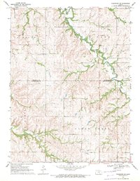
1969 Map of Frankfort SW
USGS Topo · Published 1971About this map
The rolling plains at the intersection of Marshall and Pottawatomie counties define this rural landscape. While the settlement of Blaine occupies the southern edge, the map reveals a community structured around civic halls and quiet burial grounds rather than dense urban centers. Locations like Reserville Community Hall and Lagrange Community Hall indicate the social hubs of this agrarian region during the late 1960s.
Find a feature on this map
15 named features on this map. Tap any name to fly to it.
Don’t see what you’re looking for? This feature index may not catch every label — zoom into the map to look around manually.
Map Details
Editions of this 1969 Frankfort SW Map
This is the sole edition of this map. No revisions or reprints were ever made.
Other maps of this area

1886 · Junction City
USGS Topo · 1:125,000

1889 · Seneca
USGS Topo · 1:125,000

1889 · Wamego
USGS Topo · 1:125,000

1889 · Marysville
USGS Topo · 1:125,000

1889 · Junction City
USGS Topo · 1:125,000

1894 · Junction City
USGS Topo · 1:125,000

1894 · Seneca
USGS Topo · 1:125,000

1894 · Marysville
USGS Topo · 1:125,000

1894 · Wamego
USGS Topo · 1:125,000

1955 · Manhattan
USGS Topo · 1:250,000