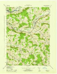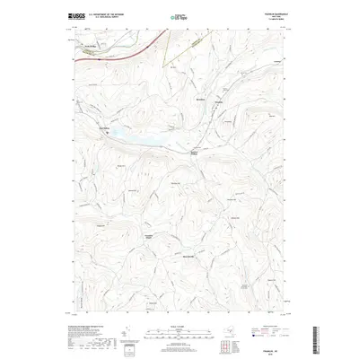
1943 Map of Franklin
USGS Topo · Published 1982About this map
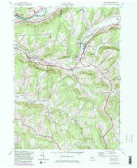
The Susquehanna River flows along the northern edge of this Delaware County landscape, marking the transition into Otsego County at Wells Bridge. This 1943 survey, updated with 1980s data, illustrates the village of Franklin and its surrounding hamlets at a time when the rural topography was still deeply shaped by its early transport history. An old railroad grade traces a path through the valley near Carrs Creek, connecting remote points like Franklin Depot and Woodford (Northfield Station). The central portion of the map is dominated by the East Sidney Lake and its associated East Sidney Lake Recreation Area, a significant water feature created along Ouleout Creek. Local history is preserved in the location of rural schoolhouses such as School No 16 and Chapel Hill Sch, and resting places like the Ouleout Valley Cemetery.
Find a feature on this map
40 named features on this map. Tap any name to fly to it.
Don’t see what you’re looking for? This feature index may not catch every label — zoom into the map to look around manually.
Map Details
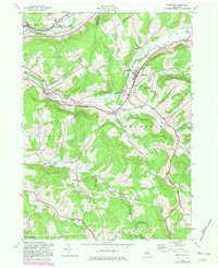
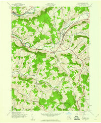
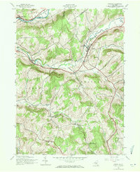
Editions of this 1943 Franklin Map
4 editions found
Historical Maps of Sidney Through Time
7 maps found