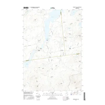
2016 Map of Franklin Falls
USGS Topo · Published 2016About this map
Franklin Falls sits at the western edge of this landscape where the Adirondack Park Preserve meets the borders of Franklin, Clinton, and Essex counties. The terrain is defined by a dense concentration of high peaks and ridges, including Esther Mtn, the Stephenson Range, and Lookout Mtn. Water systems dominate the valleys, from the broad Union Falls Pond and Franklin Falls Pond to the secluded Taylor Pond and Silver Lake. Small settlements like Forestdale and West Kilns are linked by rural routes such as Plank Rd and Co Hwy 18A, reflecting the era's blend of forestry access and residential pockets. Local history is anchored by the Union Cem and Goodspeed Cem, while the Cooper Kiln Trail suggests the long-standing recreational and industrial paths through the high country near Seberts Point and Watsons Point.
Find a feature on this map
73 named features on this map. Tap any name to fly to it.
Don’t see what you’re looking for? This feature index may not catch every label — zoom into the map to look around manually.
Map Details
Editions of this 2016 Franklin Falls Map
This is the sole edition of this map. No revisions or reprints were ever made.
Other maps of this area

1896 · Lake Placid
USGS Topo · 1:62,500

1898 · Lake Placid
USGS Topo · 1:62,500

1902 · Saranac
USGS Topo · 1:62,500

1904 · Saranac
USGS Topo · 1:62,500

1906 · Loon Lake
USGS Topo · 1:62,500

1908 · Loon Lake
USGS Topo · 1:62,500

1911 · Lyon Mountain
USGS Topo · 1:62,500

1913 · Lyon Mountain
USGS Topo · 1:62,500

1931 · Lyon Mountain
USGS Topo · 1:62,500

1948 · Ogdensburg
USGS Topo · 1:250,000