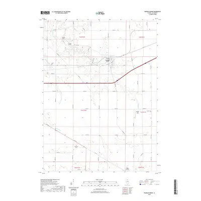
2018 Map of Franklin Grove
USGS Topo · Published 2018About this map
Franklin Grove sits as the primary settlement on this northern Illinois landscape, situated at the intersection of local routes and the rail corridor. The town's surroundings are defined by a grid of agricultural land and the winding course of Franklin Creek, which flows past the village center. A network of rural cemeteries, including Franklin Grove Cemetery and Emmert Cemetery, provides valuable markers for genealogical research in this portion of Lee County.
Find a feature on this map
52 named features on this map. Tap any name to fly to it.
Don’t see what you’re looking for? This feature index may not catch every label — zoom into the map to look around manually.
Map Details
Editions of this 2018 Franklin Grove Map
This is the sole edition of this map. No revisions or reprints were ever made.
Other maps of this area

1918 · Dixon
USGS Topo · 1:62,500

1950 · Dixon
USGS Topo · 1:62,500

1951 · Amboy
USGS Topo · 1:62,500

1952 · Rochelle
USGS Topo · 1:62,500

1952 · Mendota
USGS Topo · 1:62,500

1958 · Aurora
USGS Topo · 1:250,000

1961 · Aurora
USGS Topo · 1:250,000
1975 · Chana
USGS Topo · 1:24,000
1975 · Ashton
USGS Topo · 1:24,000
1982 · Sublette
USGS Topo · 1:24,000
Featured Places
- Franklin Grove, IL
- Ashton Township, IL
- Franklin Grove Township, IL
- Nachusa Township, IL
- Amboy Township, IL