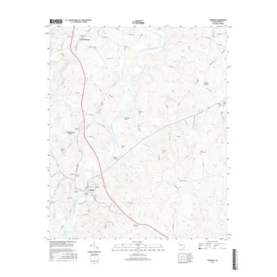
2017 Map of Franklin
USGS Topo · Published 2017About this map
Franklin serves as the focal point of this modern topographic record, where the Chattahoochee River carves a deep valley through the Georgia landscape. The map captures a high density of rural burial sites and family plots, reflecting the deep-rooted genealogy of the region with landmarks such as Franklin City Cem, Daniel Lane Cem, and Shackleford Lane Cem distributed across the ridges. North of the river, the small communities of Centralhatchee and Enon Grove maintain their distinct identities amid a network of winding local roads and creek drainages.
Find a feature on this map
97 named features on this map. Tap any name to fly to it.
Don’t see what you’re looking for? This feature index may not catch every label — zoom into the map to look around manually.
Map Details
Editions of this 2017 Franklin Map
This is the sole edition of this map. No revisions or reprints were ever made.
Other maps of this area

1899 · Wedowee
USGS Topo · 1:125,000

1902 · Wedowee
USGS Topo · 1:125,000

1953 · Atlanta
USGS Topo · 1:250,000

1957 · Atlanta
USGS Topo · 1:250,000

1958 · Atlanta
USGS Topo · 1:250,000

1964 · Hogansville
USGS Topo · 1:24,000

1964 · Glenn
USGS Topo · 1:24,000

1964 · Hillcrest
USGS Topo · 1:24,000

1964 · Roopville
USGS Topo · 1:24,000
1964 · Franklin
USGS Topo · 1:24,000