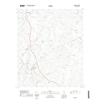
2020 Map of Franklin
USGS Topo · Published 2020About this map
Franklin serves as the seat of local government, centered on the Heard County Courthouse and the Franklin Bridge which spans the wide Chattahoochee River. The landscape is characterized by a high density of ancestral burial grounds, including the Heard Wesley Chapel Cem, Enon Grove Cem, and the Franklin City Cem. These sites, alongside smaller family plots like Vaughan Cem and McWaters Cem, provide a detailed genealogical record of the region's long-established communities.
Find a feature on this map
92 named features on this map. Tap any name to fly to it.
Don’t see what you’re looking for? This feature index may not catch every label — zoom into the map to look around manually.
Map Details
Editions of this 2020 Franklin Map
This is the sole edition of this map. No revisions or reprints were ever made.
Other maps of this area

1899 · Wedowee
USGS Topo · 1:125,000

1902 · Wedowee
USGS Topo · 1:125,000

1953 · Atlanta
USGS Topo · 1:250,000

1957 · Atlanta
USGS Topo · 1:250,000

1958 · Atlanta
USGS Topo · 1:250,000

1964 · Hogansville
USGS Topo · 1:24,000

1964 · Glenn
USGS Topo · 1:24,000

1964 · Hillcrest
USGS Topo · 1:24,000

1964 · Roopville
USGS Topo · 1:24,000
1964 · Franklin
USGS Topo · 1:24,000