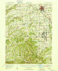
1950 Map of Franklin
USGS Topo · Published 1950About this map
The county seat of Franklin serves as the focal point of this mid-century survey, showcasing the established institution of Franklin College and the specialized grounds of the Masonic Home. To the south and east, the landscape transitions into the expansive Camp Atterbury Military Reservation, which dominates the lower half of the sheet. This military presence is marked by significant infrastructure including the U S Government RR and the Wakeman Hospital complex. A poignant historical detail is the location of the Prisoner of War Cem situated within the reservation boundaries.
Find a feature on this map
106 named features on this map. Tap any name to fly to it.
Don’t see what you’re looking for? This feature index may not catch every label — zoom into the map to look around manually.
Map Details
Editions of this 1950 Franklin Map
2 editions found

Other maps of this area

1942 · Franklin
USGS Topo · 1:125,000

1942 · Columbus
USGS Topo · 1:125,000

1946 · Belmont
USGS Topo · 1:24,000

1947 · Nashville
USGS Topo · 1:24,000

1947 · Franklin
USGS Topo · 1:62,500

1948 · Franklin
USGS Topo · 1:24,000

1948 · Edinburg
USGS Topo · 1:24,000

1948 · New Bellsville
USGS Topo · 1:24,000

1948 · Trafalgar
USGS Topo · 1:24,000

1948 · Nineveh
USGS Topo · 1:24,000