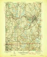
1946 Map of Franklin
USGS Topo · Published 1946About this map
Franklin and the surrounding Norfolk County landscape appear in this mid-century survey as a region defined by industrial centers and rural church crossroads. The New York New Haven and Hartford Railroad cuts a prominent diagonal path through the terrain, anchoring the development of Franklin and Woonsocket. Educational and religious institutions are significant landmarks, including Dean Academy, the St Marys Ch, and the secluded Mt St Marys Convent near the southern border.
Find a feature on this map
81 named features on this map. Tap any name to fly to it.
Don’t see what you’re looking for? This feature index may not catch every label — zoom into the map to look around manually.
Map Details
Editions of this 1946 Franklin Map
3 editions found
Other maps of this area

1886 · Blackstone
USGS Topo · 1:62,500

1887 · Franklin
USGS Topo · 1:62,500

1887 · Providence
USGS Topo · 1:62,500

1889 · Providence
USGS Topo · 1:62,500

1889 · Blackstone
USGS Topo · 1:62,500

1889 · Franklin
USGS Topo · 1:62,500

1889 · Burrillville
USGS Topo · 1:62,500

1893 · Franklin
USGS Topo · 1:62,500

1893 · Blackstone
USGS Topo · 1:62,500

1894 · Burrillville
USGS Topo · 1:62,500