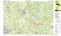
1987 Map of Franklin
USGS Topo · Published 1987About this map
Franklin and its neighboring towns in Norfolk County appear here in the late 1980s, revealing a landscape defined by significant institutional presences and extensive public lands. The map details large facilities like the Wrentham State School, the State Correctional Institute at Norfolk, and the Massachusetts Corr Institute at Walpole. These institutions, alongside Dean Jr College, represent major cornerstones of the local community and economy.
Find a feature on this map
148 named features on this map. Tap any name to fly to it.
Don’t see what you’re looking for? This feature index may not catch every label — zoom into the map to look around manually.
Map Details
Editions of this 1987 Franklin Map
2 editions found
Other maps of this area

1885 · Taunton
USGS Topo · 1:62,500

1886 · Blackstone
USGS Topo · 1:62,500

1886 · Dedham
USGS Topo · 1:62,500

1887 · Franklin
USGS Topo · 1:62,500

1887 · Providence
USGS Topo · 1:62,500

1888 · Taunton
USGS Topo · 1:62,500

1889 · Providence
USGS Topo · 1:62,500

1889 · Blackstone
USGS Topo · 1:62,500

1889 · Franklin
USGS Topo · 1:62,500

1889 · Burrillville
USGS Topo · 1:62,500