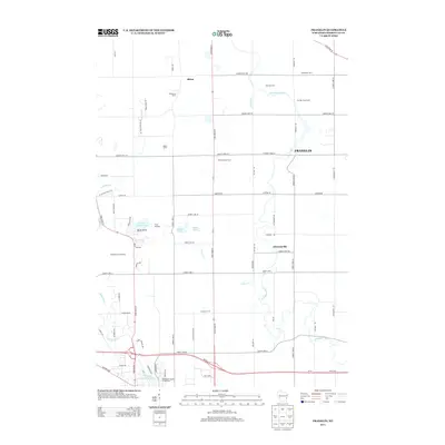
2013 Map of Franklin
USGS Topo · Published 2013About this map
The Sheboygan River meanders through this portion of Sheboygan County, anchoring a landscape defined by traditional dairy operations and modern recreational venues. Working agricultural life is visible through several named operations like the Cen Mer Dairy Farm and Arnhoelter Dairy, while the settlement of Franklin and the village of Johnsonville serve as local hubs. The area is a significant destination for outdoor enthusiasts, featuring the Road America Raceway and the Ice Age Natl Scenic Trl which skirts the western edge of the map near Little Elkhart Lake.
Find a feature on this map
69 named features on this map. Tap any name to fly to it.
Don’t see what you’re looking for? This feature index may not catch every label — zoom into the map to look around manually.
Map Details
Editions of this 2013 Franklin Map
This is the sole edition of this map. No revisions or reprints were ever made.
Other maps of this area

1954 · Sheboygan Falls
USGS Topo · 1:62,500

1954 · School Hill
USGS Topo · 1:24,000

1954 · Sheboygan Falls
USGS Topo · 1:24,000

1954 · St. Wendel
USGS Topo · 1:24,000

1954 · Howards Grove
USGS Topo · 1:62,500

1954 · Howards Grove
USGS Topo · 1:24,000

1954 · Franklin
USGS Topo · 1:24,000

1954 · Kiel
USGS Topo · 1:62,500

1954 · Milwaukee
USGS Topo · 1:250,000

1955 · Kewaskum
USGS Topo · 1:62,500