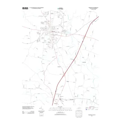
2013 Map of Franklin
USGS Topo · Published 2013About this map
Franklin anchors this 2013 survey of the Kentucky-Tennessee borderlands, where the landscape transitions from the urbanized streets of the city to the fertile agricultural plains of Mitchellville. The map captures a complex network of rural routes and family-named landmarks that define the border region. Local history is deeply etched into the terrain through numerous burial grounds like Chisholm Cem, Peden Cem, and the Duval Cem to the southwest. Waterways such as W Fork Drakes Cr and Sharps Br wind through the area, influencing the placement of early settlements and industry, most notably at Peden Mill. Small clusters such as Flat Rock and Geddes illustrate the persistent rural character of Simpson and Sumner counties, while the presence of the K and T Memorial Gardens near Black Jack reflects the community's modern landscape.
Find a feature on this map
178 named features on this map. Tap any name to fly to it.
Don’t see what you’re looking for? This feature index may not catch every label — zoom into the map to look around manually.
Map Details
Editions of this 2013 Franklin Map
This is the sole edition of this map. No revisions or reprints were ever made.
Other maps of this area

1921 · Bowling Green
USGS Topo · 1:62,500

1923 · Bowling Green
USGS Topo · 1:62,500

1928 · Adolphus
USGS Topo · 1:48,000

1931 · Adolphus
USGS Topo · 1:62,500

1942 · Gallatin
USGS Topo · 1:100,000

1951 · Woodburn
USGS Topo · 1:24,000

1951 · Franklin
USGS Topo · 1:24,000

1951 · Prices Mill
USGS Topo · 1:24,000

1951 · Auburn
USGS Topo · 1:24,000

1953 · Orlinda
USGS Topo · 1:24,000