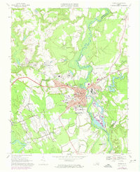
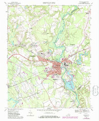
1967 Map of Franklin
USGS Topo · Published 1974About this map
The Blackwater River and Nottoway River define the hydraulic landscape of this Tidewater Virginia region, where industrial development meets established residential pockets. In the city of Franklin, the civic core is marked by the City Hall, Library, and Armory, while the industrial presence is felt through the large Industrial Waste Ponds and sewage infrastructure near the riverbanks. The era's transportation network is anchored by the Seaboard Coast Line and the Norfolk Franklin and Danville Line, which intersect to serve the local economy.
Find a feature on this map
56 named features on this map. Tap any name to fly to it.
Don’t see what you’re looking for? This feature index may not catch every label — zoom into the map to look around manually.
Map Details
Editions of this 1967 Franklin Map
5 editions found
Other maps of this area

1919 · Homeville
USGS Topo · 1:48,000

1919 · Boykins
USGS Topo · 1:48,000

1920 · Holland
USGS Topo · 1:62,500

1920 · Ivor
USGS Topo · 1:62,500

1920 · Homeville
USGS Topo · 1:62,500

1920 · Boykins
USGS Topo · 1:62,500

1943 · Holland
USGS Topo · 1:62,500

1943 · Vicksville
USGS Topo · 1:31,680

1944 · Sedley
USGS Topo · 1:24,000

1944 · Zuni
USGS Topo · 1:24,000