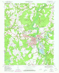
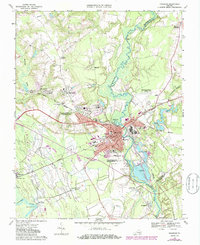
1967 Map of Franklin
USGS Topo · Published 1980About this map
The Blackwater River and Nottoway River define the movement and settlement patterns of this tidewater region, with the industrial city of Franklin serving as the central hub. This 1967 survey shows a city deeply integrated with rail and industry, evidenced by the large Industrial Waste Ponds and the intersecting routes of the Seaboard Coast Line and the Norfolk Franklin and Danville Line. Small communities and family landmarks such as Maynards Crossroads and Watkins Corner sit among the vast wetland systems of Cypress Swamp and Beaverdam Swamp. The local social fabric is traced through numerous country churches like Saint Mount Ch and White Oak Springs Ch, alongside educational institutions including Hayden High Sch and Morton Sch. This record captures the area just as suburban developments like Scottswood and Cypress Manor began to expand north of the established city center.
Find a feature on this map
71 named features on this map. Tap any name to fly to it.
Don’t see what you’re looking for? This feature index may not catch every label — zoom into the map to look around manually.
Map Details
Editions of this 1967 Franklin Map
5 editions found
Other maps of this area

1919 · Homeville
USGS Topo · 1:48,000

1919 · Boykins
USGS Topo · 1:48,000

1920 · Holland
USGS Topo · 1:62,500

1920 · Ivor
USGS Topo · 1:62,500

1920 · Homeville
USGS Topo · 1:62,500

1920 · Boykins
USGS Topo · 1:62,500

1943 · Holland
USGS Topo · 1:62,500

1943 · Vicksville
USGS Topo · 1:31,680

1944 · Sedley
USGS Topo · 1:24,000

1944 · Zuni
USGS Topo · 1:24,000