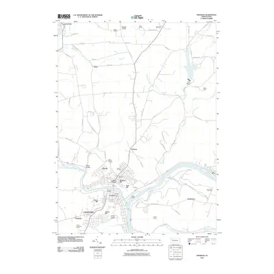
2010 Map of Franklin
USGS Topo · Published 2010About this map
The confluence of French Creek and the Allegheny River anchors this 2010 survey, illustrating a dense network of neighborhoods and cemeteries surrounding the city of Franklin. The residential landscape is deeply segmented by local elevation, with settlements like Rocky Grove, Gurney Hill, and Bleakley Hill established on the high ground overlooking the river bends. Significant aviation infrastructure is visible throughout the area, including the Chess-Lamberton Airport and smaller facilities like Hill Top Airport and Fisher Airport.
Find a feature on this map
78 named features on this map. Tap any name to fly to it.
Don’t see what you’re looking for? This feature index may not catch every label — zoom into the map to look around manually.
Map Details
Editions of this 2010 Franklin Map
This is the sole edition of this map. No revisions or reprints were ever made.
Other maps of this area

1909 · Franklin
USGS Topo · 1:62,500

1911 · Franklin
USGS Topo · 1:62,500

1922 · Oil City
USGS Topo · 1:48,000

1924 · Oil City
USGS Topo · 1:62,500

1927 · Townville
USGS Topo · 1:48,000

1927 · Titusville
USGS Topo · 1:62,500

1932 · Townville
USGS Topo · 1:62,500

1933 · Titusville
USGS Topo · 1:62,500

1943 · Oil City
USGS Topo · 1:62,500

1945 · Townville
USGS Topo · 1:62,500