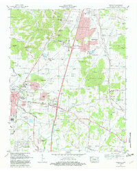
1981 Map of Franklin
USGS Topo · Published 1981About this map
The Harpeth River and its tributary, the Little Harpeth River, anchor this detailed look at Williamson County during a period of suburban expansion. The city of Franklin serves as the focal point, showing emerging residential developments like Royal Oaks and Redwing Farms encroaching upon older agricultural landscapes. Genealogists will find an exceptional density of family burial grounds, including the Owen Cem, Crockett Cem, and the Confederate Cem near McGavock Cem.
Find a feature on this map
93 named features on this map. Tap any name to fly to it.
Don’t see what you’re looking for? This feature index may not catch every label — zoom into the map to look around manually.
Map Details
Editions of this 1981 Franklin Map
2 editions found
Other maps of this area

1903 · Nashville
USGS Topo · 1:125,000

1909 · Franklin
USGS Topo · 1:62,500

1932 · Hermitage
USGS Topo · 1:62,500

1932 · Nashville
USGS Topo · 1:62,500

1936 · Spring Hill
USGS Topo · 1:24,000

1936 · Bethesda
USGS Topo · 1:24,000

1942 · Lebanon
USGS Topo · 1:100,000

1946 · Leipers Fork
USGS Topo · 1:24,000

1946 · Bethesda
USGS Topo · 1:24,000
1946 · Spring Hill
USGS Topo · 1:24,000
Featured Places
- Franklin, TN
- Brentwood, TN
- Jamestown, Brentwood
- Crockett Cove, Brentwood
- Concord Country Estates, Brentwood