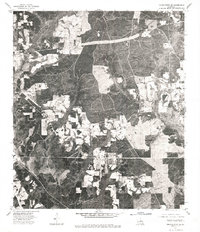
1976 Map of Franklinton SE
USGS Topo · Published 1977About this map
Sheridan anchors the upper right corner of this orthophotomap, showing the rural landscape of Washington Parish in the mid-1970s. This specific map type, an orthophotograph, replaces the standard topographic lines with a direct aerial view, revealing the intricate patterns of timber cultivation and field clearing across the Louisiana terrain. The high-contrast imagery highlights the geometric patchwork of forest and pasture, along with the narrow, winding dirt roads that connect isolated homesteads and farming operations. While traditional maps use symbols for buildings, here the literal rooftops and clearings are visible, providing a rare and direct visual record of the physical land use and settlement density during this era.
Find a feature on this map
1 named feature on this map. Tap any name to fly to it.
Don’t see what you’re looking for? This feature index may not catch every label — zoom into the map to look around manually.
Map Details
Editions of this 1976 Franklinton SE Map
This is the sole edition of this map. No revisions or reprints were ever made.
Other maps of this area

1939 · Zona
USGS Topo · 1:31,680

1939 · Clifton
USGS Topo · 1:31,680

1942 · Thigpen
USGS Topo · 1:31,680

1942 · Rio
USGS Topo · 1:31,680

1942 · Thomas
USGS Topo · 1:31,680

1949 · Bogalusa West
USGS Topo · 1:31,680

1950 · Folsom
USGS Topo · 1:31,680

1950 · Crains Creek
USGS Topo · 1:31,680

1950 · Franklinton
USGS Topo · 1:31,680

1953 · Mobile
USGS Topo · 1:250,000