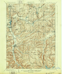
1924 Map of Franklinville
USGS Topo · Published 1932About this map
Franklinville serves as a primary hub for this Western New York rural landscape, where the valley of Ischua Creek provides a natural corridor for both road and rail. The 1920s topography reveals a densely settled agricultural region defined by a network of over two dozen local district schools, such as the Checkered School, Pigeon Hill School, and Taylor Hill School. These small schoolhouses, spaced frequently along the hills and hollows of Farmersville and Lyndon, highlight the era's localized educational structure before mid-century consolidation.
Find a feature on this map
106 named features on this map. Tap any name to fly to it.
Don’t see what you’re looking for? This feature index may not catch every label — zoom into the map to look around manually.
Map Details
Editions of this 1924 Franklinville Map
3 editions found
Other maps of this area

1898 · Olean
USGS Topo · 1:62,500

1900 · Salamanca
USGS Topo · 1:62,500

1905 · Portage
USGS Topo · 1:62,500

1906 · Angelica
USGS Topo · 1:62,500

1923 · Arcade
USGS Topo · 1:62,500

1924 · Ellicottville
USGS Topo · 1:62,500

1924 · Franklinville
USGS Topo · 1:62,500

1925 · Belmont
USGS Topo · 1:62,500

1925 · Springville
USGS Topo · 1:62,500

1925 · Arcade
USGS Topo · 1:62,500