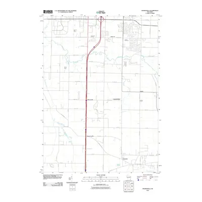
2010 Map of Franksville
USGS Topo · Published 2010About this map
Franksville and the surrounding township of Caledonia are the central focus of this 2010 survey, showcasing a landscape defined by the intersection of traditional crossroads and modern infrastructure. Small historic settlements such as Kilbournville, Thompsonville, and Husher remain distinct landmarks along the grid-like road system, which is anchored by thoroughfares like Northwestern Ave and Waukesha Rd. The map illustrates a transitional suburban character where recreational developments like the Oakwood Golf Course and Oak Hills Golf Course sit near long-established sites of local significance, including the Independent Cemetery and Caledonia Cemetery.
Find a feature on this map
62 named features on this map. Tap any name to fly to it.
Don’t see what you’re looking for? This feature index may not catch every label — zoom into the map to look around manually.
Map Details
Editions of this 2010 Franksville Map
This is the sole edition of this map. No revisions or reprints were ever made.
Other maps of this area

1891 · Bayview
USGS Topo · 1:62,500

1891 · Muskego
USGS Topo · 1:62,500

1892 · Racine
USGS Topo · 1:62,500

1893 · Silver Lake
USGS Topo · 1:62,500

1901 · Bayview
USGS Topo · 1:62,500

1901 · Muskego
USGS Topo · 1:62,500

1905 · Racine
USGS Topo · 1:62,500

1906 · Silver Lake
USGS Topo · 1:62,500

1954 · Rockford
USGS Topo · 1:250,000

1955 · Rockford
USGS Topo · 1:250,000