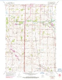
1958 Map of Franksville
USGS Topo · Published 1991About this map
The agricultural lands of Racine and Milwaukee counties are defined here by a geometric grid of rural roads, including Twomile Road, Threemile Road, and Fourmile Road, which measure the distance from the city center. The corridor is anchored by the Chicago Milwaukee St Paul and Pacific and the Chicago and North Western railroads, which facilitated the development of small farming hubs like Franksville and Thompsonville. The landscape is bisected by the Root River and its accompanying Root River Canal, where drainage and land management were critical to the area's productivity.
Find a feature on this map
57 named features on this map. Tap any name to fly to it.
Don’t see what you’re looking for? This feature index may not catch every label — zoom into the map to look around manually.
Map Details
Editions of this 1958 Franksville Map
4 editions found
Other maps of this area

1891 · Bayview
USGS Topo · 1:62,500

1891 · Muskego
USGS Topo · 1:62,500

1892 · Racine
USGS Topo · 1:62,500

1893 · Silver Lake
USGS Topo · 1:62,500

1901 · Bayview
USGS Topo · 1:62,500

1901 · Muskego
USGS Topo · 1:62,500

1905 · Racine
USGS Topo · 1:62,500

1906 · Silver Lake
USGS Topo · 1:62,500

1954 · Rockford
USGS Topo · 1:250,000

1955 · Rockford
USGS Topo · 1:250,000