
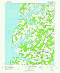
1943 Map of Franktown
USGS Topo · Published 1943About this map
Occohannock Creek and the intricate fingers of the Chesapeake Bay define the landscape of this 1943 War Department survey of Northampton County. The map details a maritime and agricultural economy deeply rooted in its geography, where narrow necks of land like Church Neck and Nassawadox Neck reach into the water. Settlement is clustered along the Pennsylvania railroad line and the traditional Bay Side Road, connecting communities like Machipongo, Birdsnest, and Bridgetown.
Find a feature on this map
58 named features on this map. Tap any name to fly to it.
Don’t see what you’re looking for? This feature index may not catch every label — zoom into the map to look around manually.
Map Details
Editions of this 1943 Franktown Map
2 editions found
Other maps of this area

1942 · Cheriton
USGS Topo · 1:24,000

1942 · Cobb Island
USGS Topo · 1:24,000

1942 · Nassawadox
USGS Topo · 1:24,000

1943 · Nassawadox
USGS Topo · 1:31,680

1943 · Jamesville
USGS Topo · 1:31,680

1943 · Exmore
USGS Topo · 1:24,000

1943 · Richmond
USGS Topo · 1:250,000

1944 · Exmore
USGS Topo · 1:31,680

1946 · Eastville
USGS Topo · 1:250,000

1948 · Cape Charles
USGS Topo · 1:24,000