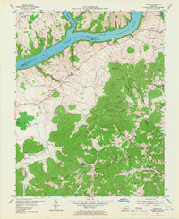
1953 Map of Frazer
USGS Topo · Published 1966About this map
Lake Cumberland dominates the northern landscape of this South Central Kentucky region, where the Cumberland River and Fishing Creek meet. In the early 1950s, the area reflects a transition from river-bottom farming to a reservoir-based economy, with the map noting a normal pool elevation of 723 feet. The interior is defined by deep hollows and named ridges, such as Doublehead Ridge and Long Ridge, which hem in small settlements and rural schoolhouses like Frazer Sch and Pole Bridge Sch.
Find a feature on this map
84 named features on this map. Tap any name to fly to it.
Don’t see what you’re looking for? This feature index may not catch every label — zoom into the map to look around manually.
Map Details
Editions of this 1953 Frazer Map
2 editions found
Other maps of this area

1911 · Monticello
USGS Topo · 1:62,500

1914 · Monticello
USGS Topo · 1:62,500

1932 · Burnside
USGS Topo · 1:62,500

1935 · Somerset
USGS Topo · 1:62,500

1953 · Frazer
USGS Topo · 1:24,000

1953 · Monticello
USGS Topo · 1:24,000

1953 · Mill Springs
USGS Topo · 1:24,000

1954 · Coopersville
USGS Topo · 1:24,000

1954 · Burnside
USGS Topo · 1:24,000

1954 · Delmer
USGS Topo · 1:24,000