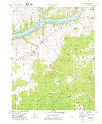
1978 Map of Frazer
USGS Topo · Published 1979About this map
Lake Cumberland and the Cumberland River dominate the northern landscape of this Wayne and Pulaski County borderland. The terrain is defined by a dense network of ridges and hollows, where small settlements like Frazer, Hardwick, and Betsey are tucked away from the river’s edge. The 1970s landscape shows the impact of the reservoir on local geography, with former creek beds submerged and boat ramps established near the Pulaski Co Wayne Co line.
Find a feature on this map
73 named features on this map. Tap any name to fly to it.
Don’t see what you’re looking for? This feature index may not catch every label — zoom into the map to look around manually.
Map Details
Editions of this 1978 Frazer Map
2 editions found
Other maps of this area

1911 · Monticello
USGS Topo · 1:62,500

1914 · Monticello
USGS Topo · 1:62,500

1932 · Burnside
USGS Topo · 1:62,500

1935 · Somerset
USGS Topo · 1:62,500

1953 · Frazer
USGS Topo · 1:24,000

1953 · Monticello
USGS Topo · 1:24,000

1953 · Mill Springs
USGS Topo · 1:24,000

1954 · Coopersville
USGS Topo · 1:24,000

1954 · Burnside
USGS Topo · 1:24,000

1954 · Delmer
USGS Topo · 1:24,000