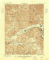
1910 Map of Frazeysburg
USGS Topo · Published 1948About this map
Dresden and Frazeysburg anchor this 1910 survey of a landscape defined by the convergence of early industrial transit and hill country farming. The Ohio Canal and several major rail lines, including the Pittsburg Cincinnati Chicago and St Louis, trace the low-lying valleys of the Licking River and Wakatomika Creek. This infrastructure reflects a transitional era where traditional water-route commerce was being superseded by high-speed rail.
Find a feature on this map
103 named features on this map. Tap any name to fly to it.
Don’t see what you’re looking for? This feature index may not catch every label — zoom into the map to look around manually.
Map Details
Editions of this 1910 Frazeysburg Map
2 editions found
Other maps of this area

1908 · Conesville
USGS Topo · 1:62,500

1909 · Newark
USGS Topo · 1:62,500

1909 · Thornville
USGS Topo · 1:62,500

1910 · Frazeysburg
USGS Topo · 1:62,500

1910 · Philo
USGS Topo · 1:62,500

1910 · Zanesville
USGS Topo · 1:62,500

1910 · Conesville
USGS Topo · 1:62,500

1912 · Gambier
USGS Topo · 1:62,500

1913 · Brinkhaven
USGS Topo · 1:62,500

1913 · Coshocton
USGS Topo · 1:62,500