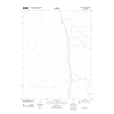
2012 Map of Frazier Creek
USGS Topo · Published 2012About this map
Henderson Creek and its many seasonal tributaries define this high-altitude landscape in central Nevada as it appeared in the early 21st century. The map centers on the open expanse of Pine Field, where the creek bed parallels a modern north-south transit corridor. Reliable water sources, essential for ranching and survival in this arid environment, are marked by McCloud Spring near Bailey Pass and Rabbit Spring to the northwest. The drainage patterns of Frazier Creek illustrate the natural runoff systems that have shaped the topography of Eureka County. This survey provides a precise look at the hydrology and land use of a region where mountain passes and intermittent springs dictated the historical movement of people and livestock.
Find a feature on this map
6 named features on this map. Tap any name to fly to it.
Don’t see what you’re looking for? This feature index may not catch every label — zoom into the map to look around manually.
Map Details
Editions of this 2012 Frazier Creek Map
This is the sole edition of this map. No revisions or reprints were ever made.
Other maps of this area

1926 · Roberts Mountains
USGS Topo · 1:250,000

1929 · Roberts Mountains
USGS Topo · 1:250,000

1937 · Mineral Hill
USGS Topo · 1:48,000

1943 · Mineral Hill
USGS Topo · 1:62,500

1949 · Garden Valley
USGS Topo · 1:62,500

1949 · Roberts Creek Mtn
USGS Topo · 1:62,500

1951 · Roberts Creek Mtn
USGS Topo · 1:62,500

1951 · Garden Valley
USGS Topo · 1:62,500

1955 · Millett
USGS Topo · 1:250,000

1955 · Winnemucca
USGS Topo · 1:250,000