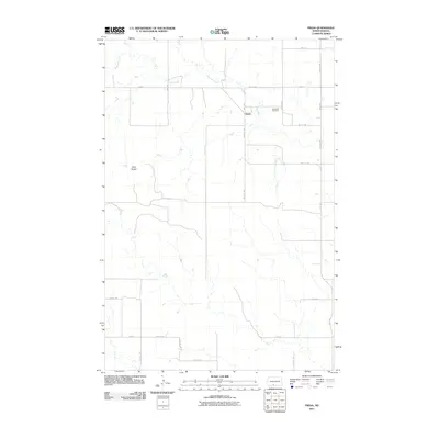
2011 Map of Freda
USGS Topo · Published 2011About this map
The small community of Freda sits at the heart of this rangeland landscape in Grant County, defined by the winding course of Dogtooth Creek. The topography is marked by significant landmarks like Three Buttes, which provide a distinct vertical break in the undulating prairie. For those tracing local heritage, Bethesda Cemetery remains a key point of interest northeast of the primary settlement area. The region is gridded by a systematic network of section-line roads, such as 81st St SW and 36th Ave, illustrating the expansive land-management patterns typical of western North Dakota. This 2011 survey reflects the enduring spatial organization of a remote agricultural district where small clusters of habitation and historic burial grounds anchor the community's geographical identity.
Find a feature on this map
22 named features on this map. Tap any name to fly to it.
Don’t see what you’re looking for? This feature index may not catch every label — zoom into the map to look around manually.
Map Details
Editions of this 2011 Freda Map
This is the sole edition of this map. No revisions or reprints were ever made.
Other maps of this area

1954 · Bismarck
USGS Topo · 1:250,000

1958 · Bismarck
USGS Topo · 1:250,000

1971 · Shields
USGS Topo · 1:24,000

1971 · Porcupine
USGS Topo · 1:24,000

1971 · Timmer
USGS Topo · 1:24,000

1980 · Freda
USGS Topo · 1:24,000

1980 · Burgess
USGS Topo · 1:24,000

1980 · Bell Coulee East
USGS Topo · 1:24,000

1980 · Dogtooth Buttes
USGS Topo · 1:24,000

1980 · Raleigh
USGS Topo · 1:24,000