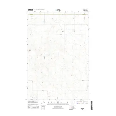
2014 Map of Freda
USGS Topo · Published 2014About this map
The settlement of Freda sits at the heart of this Missouri Plateau landscape, positioned just south of the Morton Co and Grant Co line. This 2014 survey documents a quiet rural area defined by the meandering course of Dogtooth Cr, which cuts across the northern and eastern reaches of the quadrangle. In the eastern portion, the Bethesda Cem remains a significant marker of the local community's heritage. To the west, the topography rises toward the prominent landmark of Three Buttes, punctuating the wide agricultural expanses. The map details a geometric grid of local transit routes such as 74th St SW and 80th St SW, which facilitate the movement across this sparsely populated section of North Dakota.
Find a feature on this map
14 named features on this map. Tap any name to fly to it.
Don’t see what you’re looking for? This feature index may not catch every label — zoom into the map to look around manually.
Map Details
Editions of this 2014 Freda Map
This is the sole edition of this map. No revisions or reprints were ever made.
Other maps of this area

1954 · Bismarck
USGS Topo · 1:250,000

1958 · Bismarck
USGS Topo · 1:250,000

1971 · Shields
USGS Topo · 1:24,000

1971 · Porcupine
USGS Topo · 1:24,000

1971 · Timmer
USGS Topo · 1:24,000

1980 · Freda
USGS Topo · 1:24,000

1980 · Burgess
USGS Topo · 1:24,000

1980 · Bell Coulee East
USGS Topo · 1:24,000

1980 · Dogtooth Buttes
USGS Topo · 1:24,000

1980 · Raleigh
USGS Topo · 1:24,000