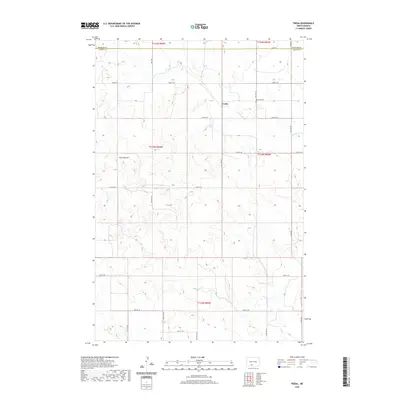
2020 Map of Freda
USGS Topo · Published 2020About this map
The small settlement of Freda serves as the focal point of this rural prairie landscape along the Morton County and Grant County line. Located in a region defined by agricultural sections and the drainage of Dogtooth Creek, the area is punctuated by the prominent Three Buttes to the west. This modern topographic survey highlights a persistent grid of section-line roads such as 34th Ave and 72nd St, which have long connected the isolated farmsteads of the North Dakota plains. Near the center of the township, the Bethesda Cemetery stands as a significant genealogical marker, recording the family history of the early settlers who established roots in these high plains. The map's detailed contouring reveals the subtle coulees and ridges that dictated the placement of early homesteads and travel routes through the North Dakota interior.
Find a feature on this map
28 named features on this map. Tap any name to fly to it.
Don’t see what you’re looking for? This feature index may not catch every label — zoom into the map to look around manually.
Map Details
Editions of this 2020 Freda Map
This is the sole edition of this map. No revisions or reprints were ever made.
Other maps of this area

1954 · Bismarck
USGS Topo · 1:250,000

1958 · Bismarck
USGS Topo · 1:250,000

1971 · Shields
USGS Topo · 1:24,000

1971 · Porcupine
USGS Topo · 1:24,000

1971 · Timmer
USGS Topo · 1:24,000

1980 · Freda
USGS Topo · 1:24,000

1980 · Burgess
USGS Topo · 1:24,000

1980 · Bell Coulee East
USGS Topo · 1:24,000

1980 · Dogtooth Buttes
USGS Topo · 1:24,000

1980 · Raleigh
USGS Topo · 1:24,000