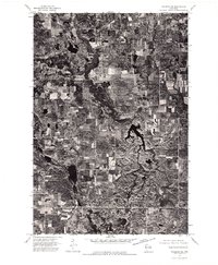
1974 Map of Frederic NE
USGS Topo · Published 1976About this map
Clam Falls serves as the primary focal point in this 1974 orthophotoquad, which captures the distinct glaciated landscape of northwestern Wisconsin. This specialized imagery, derived from high-altitude aerial photography, provides a detailed look at the rural patchwork of woodlots and agricultural clearings. The intricate network of small lakes and winding drainage patterns is clearly visible, reflecting the geological character of the region. Unlike standard topographic maps, this format emphasizes the literal ground cover of the era, showing the density of forest and the specific layout of farmsteads and field boundaries as they existed in the mid-1970s. It is a revealing record for those studying the environmental history and land use of this specific corner of Polk County.
Find a feature on this map
1 named feature on this map. Tap any name to fly to it.
Don’t see what you’re looking for? This feature index may not catch every label — zoom into the map to look around manually.
Map Details
Editions of this 1974 Frederic NE Map
This is the sole edition of this map. No revisions or reprints were ever made.
Other maps of this area

1949 · Hertel
USGS Topo · 1:48,000

1950 · Webster
USGS Topo · 1:48,000

1951 · Cumberland
USGS Topo · 1:48,000

1951 · Frederic
USGS Topo · 1:48,000

1953 · Stillwater
USGS Topo · 1:250,000

1955 · Hertel
USGS Topo · 1:62,500

1955 · Webster
USGS Topo · 1:62,500

1955 · Frederic
USGS Topo · 1:62,500

1955 · Stillwater
USGS Topo · 1:250,000

1956 · Cumberland
USGS Topo · 1:62,500