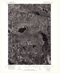
1974 Map of Frederic SW
USGS Topo · Published 1976About this map
The village of Luck stands as the primary hub of settlement in this 1974 orthophotoquad, which utilizes aerial imagery taken by the Geological Survey to document the Wisconsin landscape. The terrain is characterized by a patchwork of agricultural fields and dense woodland, punctuated by numerous glacial lakes and smaller kettle ponds. This specific survey style emphasizes the actual land use and vegetation patterns of the mid-1970s, providing a clear visual record of the rural property divisions and the extent of forest cover surrounding the village. The intricate network of township roads and agricultural clearing around Luck reflects the area's deep-rooted farming heritage and its evolution into a settled recreational landscape in the late twentieth century.
Find a feature on this map
1 named feature on this map. Tap any name to fly to it.
Don’t see what you’re looking for? This feature index may not catch every label — zoom into the map to look around manually.
Map Details
Editions of this 1974 Frederic SW Map
This is the sole edition of this map. No revisions or reprints were ever made.
Other maps of this area

1900 · St Croix Dalles
USGS Topo · 1:62,500

1901 · St Croix Dalles
USGS Topo · 1:62,500

1950 · Balsam Lake
USGS Topo · 1:62,500

1951 · Milltown
USGS Topo · 1:48,000

1951 · Frederic
USGS Topo · 1:48,000

1953 · Stillwater
USGS Topo · 1:250,000

1955 · St. Croix Dalles
USGS Topo · 1:62,500

1955 · Frederic
USGS Topo · 1:62,500

1955 · Milltown
USGS Topo · 1:62,500

1955 · Stillwater
USGS Topo · 1:250,000